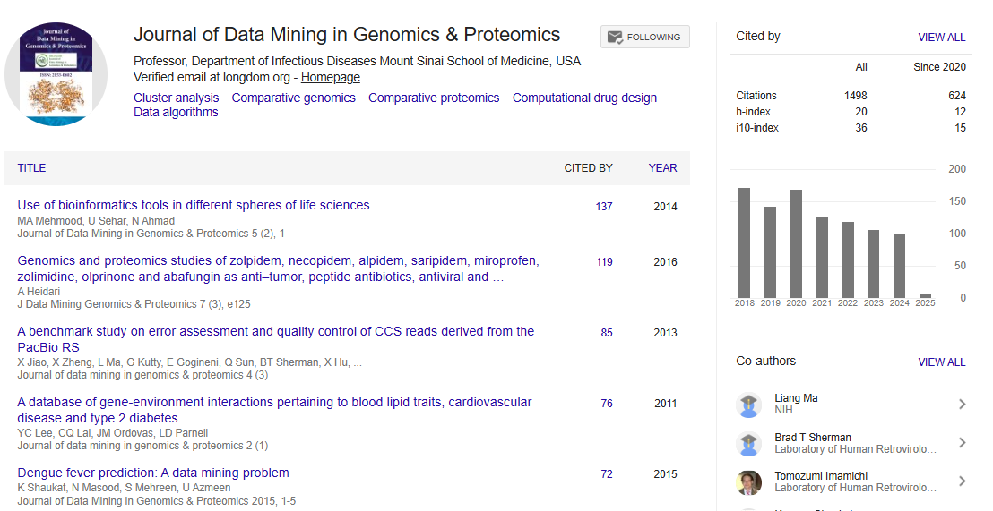

Indexed In
- Academic Journals Database
- Open J Gate
- Genamics JournalSeek
- JournalTOCs
- ResearchBible
- Ulrich's Periodicals Directory
- Electronic Journals Library
- RefSeek
- Hamdard University
- EBSCO A-Z
- OCLC- WorldCat
- Scholarsteer
- SWB online catalog
- Virtual Library of Biology (vifabio)
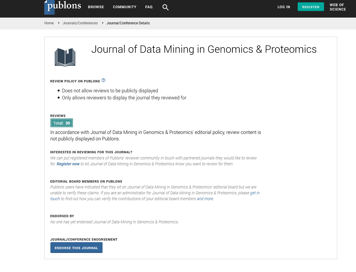
- Publons
- MIAR
- Geneva Foundation for Medical Education and Research
- Euro Pub
- Google Scholar
Useful Links
Share This Page
Journal Flyer
Open Access Journals
- Agri and Aquaculture
- Biochemistry
- Bioinformatics & Systems Biology
- Business & Management
- Chemistry
- Clinical Sciences
- Engineering
- Food & Nutrition
- General Science
- Genetics & Molecular Biology
- Immunology & Microbiology
- Medical Sciences
- Neuroscience & Psychology
- Nursing & Health Care
- Pharmaceutical Sciences
Web mapping applications: Urban land uses in the city of Kirkuk-Iraq (zone Hay Askari- case study)
2nd International Conference on Big Data Analysis and Data Mining
November 30-December 01, 2015 San Antonio, USA
Ahmed M Jihad Al-Kubaisi1 and Najib M Al-Zaidi2
1Center of the Idrisi Geographic Techniques, Iraq 2University of Tikrit, Iraq
Posters-Accepted Abstracts: J Data Mining In Genomics & Proteomics
Abstract:
This paper presents how to prepare an advanced database and create Web maps available on the Internet through the application of (ArcGIS On Line) to the city of Kirkuk, a case study. The design of effective maps on the website allows displaying data effectively so as to encourage the user to make a decision. We can use this application for the preparation of land use maps (Health -Education - Recreational - Other - Land space). The search area, the adoption of data open source, was painted in spatial layers for land use on an individual basis through the use of spatial symbols available in the application interface. It was then assembled in the map, to go beyond the possibility of participation through the media and other programs such as (Google Earth) which can be made available to decision-makers. The research aims to use Web maps available on the Internet data through the application of (ArcGis On Line) to the city of Kirkuk - the military district case study. One of the most sophisticated tools is interactive maps of the data effective Aljgraveh.valtsamam maps on the website which allows viewing data effectively, so as to encourage the user to make a decision. We can follow the search according to the style of practical work through the use of geographic and spatial data available on the Internet to prepare the land use map in the search area, and drawing classes and coding down to the interactive map can be shared and disseminated.
Biography :
Ahmed M Jihad Al-Kubaisi completed his PhD at Department of Geography, Tikrit University Iraq on specialty maps and geographic information systems. He is a member of the Iraqi Geographic Society 2011, Director of the Center for Idrisi geographic techniques- Fallujah, Iraq, Member of the Union of Iraqi Writers -2004. He also received Global certification test certificate Ic3 Computers and Information Technology. His research was published in 4 Iraqi magazines, 3 Arabic magazines and in 4 international journals. His research work in international journals has received an Impact Factor 2 and has published 2 books till date.
Email: ahmedm.jehad@yahoo.com