


Indexed In
- Open J Gate
- RefSeek
- Hamdard University
- EBSCO A-Z
- OCLC- WorldCat
- Publons
- International Scientific Indexing
- Euro Pub
- Google Scholar
Useful Links
Share This Page
Journal Flyer

Open Access Journals
- Agri and Aquaculture
- Biochemistry
- Bioinformatics & Systems Biology
- Business & Management
- Chemistry
- Clinical Sciences
- Engineering
- Food & Nutrition
- General Science
- Genetics & Molecular Biology
- Immunology & Microbiology
- Medical Sciences
- Neuroscience & Psychology
- Nursing & Health Care
- Pharmaceutical Sciences
Research Article - (2023) Volume 12, Issue 4
Future Sustainability of Coastal Agriculture using CA MARKOV Model along Nellore Coast, Andhra Pradesh using Remote Sensing and Geographical Information System (GIS)
Rajakumari Sambandan*, Sundari Sethu, Meenambikai Manickam and Sarunjith Kaladevi JayadevanReceived: 31-Jul-2023, Manuscript No. JGRS-23-22415; Editor assigned: 04-Aug-2023, Pre QC No. JGRS-23-22415 (PQ); Reviewed: 18-Aug-2023, QC No. JGRS-23-22415; Revised: 25-Aug-2023, Manuscript No. JGRS-23-22415 (R); Published: 01-Sep-2023, DOI: 10.35248/2469-4134.23.12.304
Abstract
Coastal areas provide fertile soil and suitable climatic condition for agriculture. Coastal agriculture renders significant contribution to the livelihood and economy of the local communities and also to the nation’s food production. Recent years witness visible loss in the coastal agricultural areas due to increasing climatic and non-climatic factors. Besides climatic stress, non-climatic factors such as growing population, land conversions and other economic activities induce dramatic changes in the extent of agricultural lands especially along the coast. This study attempted to assess the impact of the non-climatic factors on coastal agricultural areas of Nellore in Andhra Pradesh. The period of assessment is from 1990 to 2020 using temporal satellite images. The study indicated a loss of about 28% of arable lands within the assessed period. Using the past trends, the status of the agricultural lands in 2030 is, Geographical Information System (GIS) and spatial modeling techniques are used for the assessment.
Keywords
Coastal agriculture; Non-climatic factors; Geographical Information System (GIS); Prediction; Impacts; Sustainability
Introduction
Riverine deltaic plains are flat and fertile coastal areas more suitable to agriculture activities. Owing to their resource richness and livelihood opportunities, these fertile lands are utilized for non-agricultural activities in the recent decades [1-9]. India though being the second largest agriculture dependent country globally is no exception for this conversion trend [10]. Due to increasing climatic and non-climatic stress factors, arable lands especially in the coastal areas undergo rapid depletion. Despite new techniques in agricultural activities traditional crop lands witness higher rate of conversion [11]. The present study is objected to assess the status of arable lands along the Nellore coast due to non-climatic factors. Nellore is famous for rice production and aqua (prawn and fish) culture. Nellore district is called the “Shrimp capital of India” due to its high production of cultured shrimp. About 70% of the total work force is dependent upon agriculture either as farmers or as agricultural labor [12]. Despite fertile cultivation lands, recent years show a high trend towards aquaculture in the area than agriculture. The objective of the study is to assess the dynamics of arable lands in the last 3 decades from 1990 to 2020 using temporal satellite images of the area with a prediction for 2030 using Land Change Model (LCM). Studies on rapid decrease and conversion of arable lands are attempted worldwide to understand the influence of climatic and non-climatic factors on these fertile lands to plan strategies to sustain the areas for crop productions [13]. Repetitive capture of the area using Remote sensing images and GIS analysis techniques of spatial data find wide application for such studies.
Study area
Sri Potti Sriramulu Nellore (SPSN) district formerly called as Nellore is one of the coastal district of Andhra Pradesh located north of Tiruvallur district of Tamil Nadu. The district has about 48 taluks of which 3 taluks namely Chittamur, Vakadu and Kota are considered for the study of area 747 km2 and with a coastal length of 40.2 km. The area is a riverine alluvium delta formed by Swarnamukhiriver (Figure 1) [14]. The area is traditionally utilized for cultivation and in recent years rapid conversion of crop lands to non-agricultural activities is the prime reason to consider the area for the study. The geographical coordinates of the area is from 79° 55’ 30”E, 13°49’45”N to 80° 15’00”E, 14° 10’00”N.

Figure 1: Nellore coast, Andhra Pradesh.
Data source
Temporal satellite data of the past three decades were used to identify and map different Land Use and Land Cover (LULC) features in the study area. The satellite data of different period used for the study are tabulated in Table 1.
| Year | Image | Date | Datum | Spatial resolution (m) |
|---|---|---|---|---|
| 1990 | Landsat | 20-10-1990 | UTM44/WGS84 | 30 |
| 2000 | Landsat | 28-10-2000 | UTM44/WGS84 | 30 |
| 2010 | Sentinel 2A | 16-09-2010 | UTM44/WGS84 | 10 |
| 2020 | Sentinel2A | 26-10-2020 | UTM44/WGS84 | 10 |
Table 1: Temporal satellite data.
| LULC | Area (km2) | ||||
|---|---|---|---|---|---|
| 1990 | 2000 | 2010 | 2020 | 2030 | |
| Agriculture | 290.44 | 269.57 | 245.84 | 207.68 | 163.42 |
| Abandoned aquaculture | 0 | 0 | 2.82 | 0.79 | 0.17 |
| Aquaculture | 0.82 | 9.51 | 20.31 | 41.64 | 94.16 |
| Canals | 2.75 | 2.66 | 2.62 | 2.51 | 2.07 |
| Coastal dunes | 13.62 | 13.55 | 10.62 | 8.52 | 7.54 |
| Fallow land | 56.53 | 74.35 | 98.61 | 135.14 | 176.02 |
| Industry | 0.03 | 0.13 | 0.24 | 0.35 | 0.49 |
| Lagoon | 12.65 | 14.95 | 15.12 | 15.25 | 15.62 |
| Lakes | 8.88 | 9.01 | 9.99 | 10.11 | 10.48 |
| Scrub lands | 157.18 | 154.22 | 141.22 | 120.05 | 67.05 |
| Vacant lands | 58.77 | 49.34 | 41.64 | 35.27 | 24.36 |
| Mangroves | 0.64 | 0.81 | 1.04 | 1.18 | 1.25 |
| Mudflats | 34.52 | 35.01 | 35.84 | 36.51 | 37.02 |
| Plantation | 20.03 | 20.57 | 22.85 | 24.78 | 27.84 |
| Reserve forest | 6.01 | 6.01 | 5.99 | 5.97 | 5.95 |
| River | 11.1 | 10.95 | 10.52 | 9.92 | 9.27 |
| Saltpans | 0.1 | 0.16 | 0.22 | 0.24 | 0.31 |
| Sandy area | 10.85 | 10.61 | 10.52 | 10.18 | 9.74 |
| Sandy beach | 1.74 | 1.47 | 1.34 | 1.26 | 1.11 |
| Settlements | 12.91 | 18.84 | 26.55 | 38.21 | 56.21 |
| Tanks | 42.61 | 41.08 | 40.35 | 39.24 | 35.44 |
| Waterlogged area | 4.61 | 3.99 | 2.54 | 1.99 | 1.27 |
| Total area (km2) | 746.79 | 746.79 | 746.79 | 746.79 | 746.79 |
Table 2: Temporal LULC features in the study area.
| Accuracy | LULC Features (Support Vector Machine (SVM) classifier) | |||
|---|---|---|---|---|
| 1990 | 2000 | 2010 | 2020 | |
| Overall classification | 88.26% | 91.18% | 92.36% | 93.68% |
| Kappa statistics (k) | 0.8717 | 0.9074 | 0.9151 | 0.9301 |
| Producer accuracy | 85.20% | 89.40% | 91.60% | 92.80% |
| User accuracy | 87.60% | 86.70% | 90.30% | 93.10% |
Table 3: Accuracy assessment of classified land use and land cover features.
Materials and Methods
Temporal raw satellite images of the study area for the periods 1990, 2000, 2010 and 2020 are georeferenced and projected to Universal Transverse Mercator (UTM), zone- 44N and datum-WGS 84. The rectified images are interpreted for different LULC features using Support Vector Machine (SVM) classifier. Prediction of the LULC features of the area for 2030 is attempted in the study using the past trends in LULC using Cellular Automation Coupled with Markov model called as ‘CA MARKOV’ prediction model. The method adopted for the study is explained in Figure 2.

Figure 2: Support vector machine methodology for raw satellite prediction and accuracy.
Support Vector Machine (SVM) classifier
The Support Vector Machine (SVM) is capable of delivering higher performance in terms of classification accuracy than other data classification algorithms [15,16]. SVM is a binary classifier based on supervised learning which gives better performance than other classifiers. SVM classifies between two classes by constructing a hyper plane in high-dimensional feature space which can be used for classification. SVM are effective in high dimensional spaces. It uses a subset of training points in the decision function (called support vectors) and is also memory efficient. The interpreted features of different periods are spatially quantified for their change analysis between 1990 and 2020.
Cellular Automation Markov (CA MARKOV) model
Prediction of land features especially agriculture lands for 2030 is one of the upscaled aims of the study. Cellular Automation coupled with Markov model (CA-Markov), is used as it is the most widely used approach to predict the spatio-temporal dynamics of land features [17-27].
There are two components in the model;
a) Determination of the temporal dynamics in the land features on a pixel by pixel basis using Markov approach.
b) Prediction of future spatial and temporal dynamics of land features based on the set of rules and probabilities generated by the model in the first.
GIS and remotely sensed data were used to define initial conditions and extent of land features. The predicted model of land features was developed in IDRISI TerrSet software to monitor the pattern changes. In order to estimate the reliability and accuracy of the predicted data, error matrix analysis and Kappa statistics were performed. Error matrix analysis indicates the consistency percentage between the actual and predicted values for each of the land feature classes considered, while kappa coefficient indicates the correctness and correlation of the actual and predicted features on a pixel by pixel basis. In the present study, 2010 was considered as the base year for assessing changes in land features. Generally the base year considered for prediction should be a normal year with no abnormal natural calamities recorded.
As 2010 was found suitable, the interpreted land features of 2010 and 2020 were used in the first component of the model to generate.
• Rule-based transition probability matrix.
• Conditional probability map.
• Transition area matrix on pixel basis.
The derived transition probabilities were used as input to the second component of the model to generate the spatial and temporal dynamics in the land features for the year 2030. As explained earlier, the accuracy assessment of the model derived data was obtained by using 2000 and 2010 data for generating the land features dynamics in 2020, using the method detailed above for future prediction (Figure 2). For the purpose of validation, the model generated 2020 land features were compared with the actual 2020 land features data. The error matrix and kappa Coefficient of correlation for the 2020 predicted data were found to be about 92% to 94% for all the land features in the study area [28].
Results and Discussion
Temporal satellite images of 1990, 2000, 2010 and 2020 are used for interpretation of different land features using SVM classifier method using the LULC classification method adopted by Space Application Centre (SAC) [29,30]. The land features observed in the study area includes agricultural lands, aquaculture farms, sand dunes with and without vegetation, scrub lands, vacant lands, plantations, industrial areas and waterbodies such as rivers, canals, lakes, tanks and small patches of discontinuous water logged areas. Sparse patches of mangroves and mudflats are the Ecological sensitive areas found in the study location. Narrow stretch of continuous beaches is found in this coastal zone. Significant habitation areas include Tupilipalem, Zameen Kothapalam, Islamattu, Vakadu, Mallamu, Chittamuru. The total area considered for the study is about 746.79 km2 of which about 39% of the area is under agriculture followed by 21% of scrub lands. Rapid changes in land uses are noticed in the last 2 decades dominated with boom of aquaculture farms and growing habitation areas as indicated in Table 2 [31]. Proportion of agriculture and aquaculture areas at different time period indicate that among the different land use changes decrease in agriculture lands and increase in aquaculture farms are significantly high (Figure 3).

Figure 3: Dynamics of agriculture vs. aquaculture (1990-2020) with prediction for 2030.
The predicted scenario of the land uses based on past trends is attempted in the study using Land Change Modeler (LCM) and the study indicated a possible increase in aquaculture in 2030. The study indicated a decrease in the extent of crop area from 290.44 km2 in 1990 to 207.68 km2 in 2020. Nearly 83 km2 of crop lands (i.e.28% of crop area) were converted to other land uses such as aquaculture farms, settlements, commercial areas, plantations, water storage areas such as tanks, canals or as scrub lands (Figures 4a-4d).

Figure 4a: Economic activity vs. decreasing arable lands.

Figure 4b: Growing population vs. decreasing arable lands.

Figure 4c: Converted land features vs. decreasing arable lands.

Figure 4d: Fragmented arable lands for different activities.
The study further indicated a gradual increase in the fallow lands from 1990 to 2020 (Table 2). Assessment of the reutilization of fallow lands indicated that about 46% of the fallow lands were used for agriculture and about 23% for aquaculture farms, 9% to habitation and about 22% to other land uses such as tanks, plantations, commercial areas or left unutilized as scrub lands over the assessed period. The changes in the land uses further indicated noticeable migration of human settlement areas and economic activities in the coastal zone than in the inland owing to wider resource opportunities. For instance, aquaculture farms and human habitations found at about 1 km to 1.3 km from the coast in 1990 were found at about 500 m from the coast in 2020. The settlement areas are found to increase 3 times in 2020 (38.21 km2) compared to 1990 (12.91 km2) and predicted to increase further in 2030 as stated by the United Nations Convention to combat Desertification (UNCCD) and aquaculture farms has increased 50 times between 1990 and 2020 as also indicated by other sources [32,33]. Other significant features with dynamic changes include scrub and vacant lands available in the study area besides agriculture and fallow lands. Increasing coastal population and economic activities replacing agriculture areas clearly indicate the need of the local communities for better livelihood opportunities and resources. The future trend of the coastal agriculture attempted in the study indicates the possibility of significant replacement of crop areas by other activities in many places (Figure.3). Coastal natural features may be disturbed to a greater extent in future as indicated by the predictions. A unique aspect in the distribution of land uses in the study area is that significant proportions of land are found as scrub (16% to 21%) and vacant lands (5% to 8%) due to its rocky nature [34]. Availability of these features is considered as an additional factor for rapid growth of economic and habitation areas.
Accuracy assessment of classified features
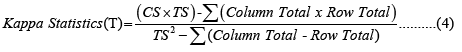
The accuracy assessment of classified features is essential to ensure the reliability of the interpreted temporal land use and land cover features [35-40]. Accuracy can be expressed in two ways namely ‘Overall accuracy of classification’ and ‘Kappa statistics’. Overall Accuracy indicates the proportion of all the reference sites considered for classification upon the number of sites correctly classified and it is usually expressed as percent. The kappa statistics indicates the closeness of the instances classified by the machine learning classifier upon the actual data and is expressed in decimal [41]. The expressions used for accuracy assessments are given in equations 1 to 4. The most accurate classification is expressed as value 1 and the accepted level of accuracy of the interpreted features obtained using Remote Sensing data is about 85% as recommended by different authors [42,43]. The detail accuracy classification for the years 1990, 2000, 2010 and 2020 are tabulated in Table 3.


Where,
CS–Correct Samples
TS–Total Samples
Village wise status of decreased arable lands
Gradual decrease of arable lands is the major concern of the study. Figure 5 indicates the temporal changes in the agricultural lands over the study period. The existing traditional crop areas from 1990 to 2020 were indicated as light green. Newly converted arable lands between 1990 and 2020 mostly from vacant and scrub lands are indicated in dark green color while expected new agriculture areas predicted for 2030 is indicated as yellow. Similarly lost agriculture areas between 1990 and 2020 are indicated in red and expected loss of agriculture lands in 2030 is indicated in violet color. The assessment clearly indicated a higher proportion of loss than new agriculture areas both in the present and in predicted scenarios. The new and loss of crop lands in the present scenario was in the ratio of 1:3 while the same showed an escalated ratio of 1:4 in 2030.

Figure 5: Village wise status of decreased arable lands (1990 to 2020).
The higher ratio of loss can be interpreted as the chances of increased magnitude of stress factors on agriculture lands in future. Continuous stress and loss of coastal arable lands can aggravate a serious setback on the sustainability of food production capacity of the area. Further to indicate, Figure 6 shows a gradual to rapid conversions of arable lands in the neighborhood coastal areas between 1990 and 2020. Continuous conversion of arable lands needs immediate and serious attention to avoid imbalance in the food production of the state and for the nation.

Figure 6: Converted traditional arable lands to economic activities (1990 to 2020).
The village wise assessment of decreased arable lands over the study period. There are about 110 villages within the study area of different dimensions and most of the villages practice agriculture as their traditional occupation except villages close to the coast. Changes in arable areas over the study period included both improvement and loss in various proportions. High rate of conversion is found dominant in the villages close to the water bodies (indicated in red in Figure 5) between 1990 and 2020. However predicted scenario indicated distributed loss of arable lands indicated in violet (Figure 5). According to the present study, the overall improvement in the extent of arable lands in the last two decades is about 9% and loss is about 28%. However the predicted scenario for the next decade shows a decreased proportion in the gain and a higher proportion in loss of arable lands indicating the possibility of higher rate of conversion of arable lands in future. Changes in the arable lands are further assessed village wise to understand villages with significant loss and gain of arable lands over the study period. The assessment indicated that no villages had negligible change in their arable land extents between 1990 and 2020. For better assessment of the changes in arable lands, areas with more than 20% improvement in crop lands were indicated in green, areas lost more than 20% of their traditional arable lands are indicated in red and areas with less than 20% improvement and loss are shown in yellow in Figure 5. The status classification of villages based on changes in their arable extents was not found to have any particular trend over the years.
This pattern of conversion clearly indicated the urge of the locals for better alternative livelihood opportunities to traditional agriculture. Despite the fact that decline of cropping areas would impinge a serious imbalance in country’s food production, the trend continues to prevail. The study indicated that out of the 110 villages, about 33 are under high loss of arable areas, 32 are under significant improving areas, 31 villages have <20% proportion of loss and new arable areas and 14 villages mostly close to the coast have no agriculture areas mainly due to poor groundwater areas and saline water intrusions [44]. The details of villages in each category were tabulated in Tables 4a-4d.The fact of concern from the study is the increasing number of villages with loss of arable lands than the other two categories. Also noted during the study is the increasing loss of arable lands for similar alternative activities in the adjacent taluk of Nellore district (Figure 6).
| Village ID | Village name |
|---|---|
| 6 | Pallamala |
| 7 | Nellorepalle |
| 19 | Kothapalem |
| 23 | Yaragatipalle |
| 24 | Pulikorru |
| 42 | Gudali |
| 43 | Chittodu |
| 44 | Rudravaram |
| 45 | Kesavaram |
| 48 | Kurugonda |
| 49 | Chillamathur |
| 50 | Kuchiwada |
| 51 | Gunupadu |
| 52 | Annamedu |
| 53 | Mettu |
| 54 | Kondapuram |
| 55 | Pellakuru |
| 56 | Eswarawaka |
| 57 | Chittamur |
| 59 | Kalluru |
| 60 | Cherukumolam |
| 74 | Vadlavanipalle |
| 76 | Pittivanipalle |
| 87 | Reddipalem |
| 92 | Kummarapalem |
| 94 | Kalagurthipadu |
| 95 | Aruru |
| 98 | Yellasiri |
| 99 | Mannemala |
| 100 | Chillamuru |
| 106 | Gottiprolu |
| 107 | Yakasri |
| 109 | Marlapalle |
| Total villages | 33 |
Table 4 (a): Details of villages with different arable land dynamics with >20% Loss of arable lands.
| Village ID | Village name |
|---|---|
| 4 | Karlapudi |
| 8 | Uthamanellore |
| 9 | Illukurupadu |
| 10 | Putchalapalle |
| 16 | Allampadu |
| 17 | Vanjivaka |
| 18 | Kota |
| 21 | Lakshmakka |
| 22 | Thinnelapudi |
| 25 | Ganganapalem |
| 33 | Nagulamarri |
| 34 | Gundlu |
| 36 | Polla |
| 38 | Pudilayadoruvu |
| 40 | Vakadu |
| 47 | Maddali |
| 61 | Tirumur |
| 62 | Uttara |
| 63 | Putragunta |
| 64 | Pothunayanipalle |
| 73 | Mallam |
| 75 | Durgavaram |
| 77 | Devuni |
| 110 | Molaganur |
| 79 | Somasamudram |
| 80 | Kogili |
| 81 | Ranganathapuram |
| 82 | Perantravulamitta |
| 83 | Ellore |
| 85 | Jalapeddipalem |
| 86 | Veligajulapalle |
| 91 | Buradagali |
| Total Villages | 32 |
Table 4 (b): Details of villages with different arable land dynamics with>20% New arable lands.
| Village ID | Village Name |
|---|---|
| 1 | Turpu |
| 2 | Kothapatnam |
| 3 | Siddavaram |
| 5 | Vellapalem |
| 15 | JaminKothapalem |
| 20 | Chendodu |
| 26 | Iskamattu |
| 35 | Chennappagarimitta |
| 37 | Kotha |
| 39 | Nellipudi |
| 41 | Kasipuram |
| 46 | Kadivedu |
| 58 | Muttembaka |
| 66 | Mangalavaripalle |
| 67 | Mukkidipalem |
| 68 | Duggaraja |
| 69 | Gangupalem |
| 70 | Gollapalem |
| 71 | Kothapalem Bit I |
| 72 | Kokkupalem |
| 78 | Padarthivari |
| 84 | Palamparthy |
| 90 | Reddipalem |
| 93 | Karikadu |
| 96 | Varthur |
| 97 | Tadimedu |
| 101 | Puderu |
| 102 | Molakalapudi |
| 103 | Uppalamarthi |
| 104 | Addepudi |
| 105 | Marlamudi |
| Total Villages | 31 |
Table 4 (c): Details of villages with different arable land dynamics with <20% Loss and New arable lands.
| Village ID | Village name |
|---|---|
| 11 | Valamedu |
| 12 | Pathetipalem |
| 13 | Andalamama |
| 14 | Namkadu |
| 27 | Juvvinattu |
| 28 | Budidalawagu |
| 29 | Konduru |
| 30 | Manyalanattu |
| 31 | Namkadu bit I |
| 32 | Kapparampadu |
| 65 | Cheemalapadu |
| 88 | Pambali |
| 89 | PudiyaYadoruvu |
| 108 | Ravulagunta |
| Total villages | 14 |
Table 4 (d): Details of villages with different arable land dynamics with no arable lands.
Suggestions to sustain coastal agriculture
India is the second largest agriculture based country with more than 58% of its dependent population. Though annual food production statistics show an increasing trend, the spatial extents of arable lands show a significant decrease in the recent years due to increasing interventions of capital intensive activities. Besides economy, lack of skilled laborers, degradation in soil fertility, frequent disaster damages, dynamic changes in adjacent land uses are some of the key driving factors responsible for decrease in arable lands. The changes in the arable lands based on their size from the present study indicated a loss of about 69% of small lands with less than 1 km2 to other activities during 1990 and 2020 due to limited capacity of the land holders to defend their economic needs. Fragmentation of arable lands to accommodate parallel high income economic activities such as aquaculture farms are noticed in the study. These non-agricultural conversion factors resulted in increase of fragmented lands with area about 5 km2 by 24% from large arable lands with more than 5 km2 which indicated in Figure 7. The geological formations of the area comprise of river alluvium, coastal alluvium and windblown sand deposits of quaternary period. The study area falls under the river alluvium formed by Swarnamukhi river delta and coastal alluvium. Though the ground water zones are significantly good in these areas saline intrusion forms a major setback in the water quality which is implicated in the irrigation and sustainability of crop lands in the area [14,45]. Major factors responsible for ground water salinity are localized high nitrate pollution due to excess use of fertilizers, urban sewage disposals, improper drainage systems and unregulated growth of aquaculture farms in the area. The present rate of loss of arable lands may convert the area from agriculture based to economic based zone in the future.

Figure 7: Changes in the traditional arable lands from 1990 to 2030.  Arable lands>5 sqkm.
Best practices as suggested by several agricultural experts includes:
a) Adaptation of new variety of crops that uses less water, pest resistant, saline tolerant, flood managing and high temperature withstanding.
b) Combination of traditional and new biotechnological approaches in farming.
c) Mixed crops.
d) Integration of agriculture with other accommodative activities such as forestry and fisheries.
e) To avoid land and water deteriorating activities in close proximity.
f) To plan and to include agriculture in integrated management plan for coastal areas.
g) Training and awareness programs for traditional farmers about global climate change challenges, disaster mitigation measures, and modern methods of farming and skill development programs on modern equipment.
Encouragement in the form of incentives, competitive market prices and loans to motivate educated young locals to agricultural sector. Periodic discussion to address the issues of farmers may provide a better scientific and strategic approach to sustain fertile coastal arable lands for their actual purpose and service. The effective plans may avoid or rather minimize the rate of conversion of coastal arable lands as indicated in the present and predicted scenario in Figure 8 and would provide a better improved coastal arable lands in future indicated as “Envisaged” status of the arable lands in future. The status of various features as obtained from the field verification was shown in Figure 9 [46].

Figure 8: Envisaged status of arable lands in the study area.

Figure 9: Field locations of the study area. Note: a) Agriculture field; b) Field adjacent to canal; c) Scrub land; d) Aquaculture farm; e) Mixed crop; f) Irrigation tank
Conclusion
The study assessed the changes in the arable lands of the 3 taluks of Nellore district namely Chittamur, Vakadu and Kota for the period 1990 to 2020. The study indicated a loss of 28% of arable lands to other non-agricultural activities mainly aquaculture farms and settlement areas. The predicted status of the arable lands for 2030 indicated a further loss of 21% of arable lands o aquaculture, settlement and other non-agricultural activities. Upon the present and future scenario of arable lands, the study indicated suggestions to sustain the fertile traditional arable lands for crop production rather to convert to capital intense activities. Attention, remedial measures and plans to sustain arable lands are the immediate requirement against the forthcoming threat “No land to farm”.
References
- Rogers KG, Syvitski JP, Overeem I, Higgins S, Gilligan JM. Farming practices and anthropogenic delta dynamics. Deltas: Landforms ecosystems and human activities. 2013;358:133-142.
- Al Tarawneh WM. Urban sprawl on agricultural land (literature survey of causes, effects, and relationship with land use planning and environment): A case study from Jordan (Shihan municipality areas). Journal of Environment and Earth Science. 2014;4(20):97-124.
- Bren d’Amour C, Reitsma F, Baiocchi G, Barthel S, Güneralp B, Erb KH, et al. Future urban land expansion and implications for global croplands. Proceedings of the National Academy of Sciences. 2017;114(34):8939-8944.
[Crossref] [Google Scholar] [PubMed]
- Loucks DP. Developed river deltas: Are they sustainable? Environmental Research Letters. 2019 Nov 6;14(11):113004.
- Li S, Nadolnyak D, Hartarska V. Agricultural land conversion: Impacts of economic and natural risk factors in a coastal area. Land Use Policy. 2019;80:380-390.
- Gopalakrishnan T, Hasan MK, Haque AS, Jayasinghe SL, Kumar L. Sustainability of coastal agriculture under climate change. Sustainability. 2019;11(24):7200.
- Singh A, Fernando RL, Haran NP. Development in coastal zones and disaster management. Palgrave Macmillan; 2020.
- Beckers V, Poelmans L, Van Rompaey A, Dendoncker N. The impact of urbanization on agricultural dynamics: A case study in Belgium. Journal of Land Use Science. 2020;15(5):626-643.
- Nong DH, Ngo AT, Nguyen HP, Nguyen TT, Nguyen LT, Saksena S. Changes in coastal agricultural land use in response to climate change: An assessment using satellite remote sensing and household survey data in Tien Hai district, Thai Binh Province, Vietnam. Land. 2021;10(6):627.
- Pandey B, Seto KC. Urbanization and agricultural land loss in India: Comparing satellite estimates with census data. Journal of environmental management. 2015;148:53-66.
[Crossref] [Google Scholar] [PubMed]
- Brodt S, Six J, Feenstra G, Ingels C, Campbell D. Sustainable agriculture. Nat Educ Knowl. 2011;3(1).
- Simhapuri V. About Sri Potti Sriramulu Nellore District. 2022.
- Viana CM, Freire D, Abrantes P, Rocha J, Pereira P. Agricultural land systems importance for supporting food security and sustainable development goals: A systematic review. Science of the total environment. 2022;806:150718.
[Crossref] [Google Scholar] [PubMed]
- Kumar PG, Louis C, Pillai RS, Sabna T. Ground water brochure Nellore District, Andhra Pradesh, Central Ground Water Board (CGWB). 2013.
- Taati A, Sarmadian F, Mousavi A, Pour CT, Shahir AH. Land use classification using support vector machine and maximum likelihood algorithms by Landsat 5 TM images. Walailak Journal of Science and Technology (WJST). 2015;12(8):681-687.
- Shi D, Yang X. Support vector machines for land cover mapping from remote sensor imagery. Monitoring and Modeling of Global Changes: A Geomatics Perspective. 2015:265-279.
- Hamad R, Balzter H, Kolo K. Predicting land use/land cover changes using a CA-Markov model under two different scenarios. Sustainability. 2018;10(10):3421.
- Liping C, Yujun S, Saeed S. Monitoring and predicting land use and land cover changes using remote sensing and GIS techniques—A case study of a hilly area, Jiangle, China. PloS one. 2018;13(7):e0200493.
- Chotchaiwong P, Wijitkosum S. Predicting urban expansion and urban land use changes in Nakhon Ratchasima City using a CA-Markov model under two different scenarios. Land. 2019;8(9):140.
- Aliani H, Malmir M, Sourodi M, Kafaky SB. Change detection and prediction of urban land use changes by CA–Markov model (Case study: Talesh County). Environmental Earth Sciences. 2019;78:1-2.
- Ruben GB, Zhang K, Dong Z, Xia J. Analysis and projection of land-use/land-cover dynamics through scenario-based simulations using the CA-Markov model: A case study in guanting reservoir basin, China. Sustainability. 2020;12(9):3747.
- Khan Z, Khan Z, Ahmed A, Bazai MH. Land use/land cover change detection and prediction using the CA-Markov model: A case study of Quetta city, Pakistan. Journal of Geography and Social Sciences (JGSS). 2020;2(2):164-182.
- Mondal MS, Sharma N, Kappas M, Garg PK. CA MARKOV modeling of land use land cover change predictions and effect of numerical iterations, image interval (time steps) on prediction results. The International Archives of the Photogrammetry, Remote Sensing and Spatial Information Sciences. 2020;43:713-720.
- Gemitzi A. Predicting land cover changes using a CA Markov model under different shared socioeconomic pathways in Greece. GIScience & Remote Sensing. 2021;58(3):425-441.
- Mathanraj S, Rusli N, Ling GH. Applicability of the CA-Markov model in land-use/land cover change prediction for urban sprawling in Batticaloa municipal council, Sri Lanka. InIOP Conference Series: Earth and Environmental Science 2021;620(1):012015. IOP Publishing.
- Wang SW, Munkhnasan L, Lee WK. Land use and land cover change detection and prediction in Bhutan's high altitude city of Thimphu, using cellular automata and Markov chain. Environmental Challenges. 2021;2:100017.
- Ghalehteimouri KJ, Shamsoddini A, Mousavi MN, Ros FB, Khedmatzadeh A. Predicting spatial and decadal of land use and land cover change using integrated cellular automata Markov chain model based scenarios (2019–2049) Zarriné-Rūd River Basin in Iran. Environmental Challenges. 2022;6:100399.
- Arumugam T, Yadav RL, Kinattinkara S. Assessment and predicting of LULC by Kappa analysis and CA Markov model using RS and GIS techniques in Udham Singh Nagar District, India. 2021.
- Nayak S. Use of satellite data in coastal mapping. Indian Cartographer. 2002;22(1):147-157.
- Nayak S, Bahuguna A, Shaikh M, Rao RS, Trivedi CR, Prasad KN, et al. Manual for Mapping of Coastal Wetlands/landforms and Shoreline Changes Using Satellite Data, 63. Technical Note. IRS-UP/SAC/MCE//SN/32/91. Ahmedabad, India: Space Applications Centre. 1991.
- Farmers turn away from agriculture to fish farming in Andhra Pradesh. 2022.
- Urbanisation to cause huge loss of prime farmland: UNCCD. 2022.
- An abundance of aquaculture in Andhra Pradesh. 2022.
- Nellore population. 2022.
- Foody GM. Status of land covers classification accuracy assessment. Remote sensing of environment. 2002;80(1):185-201.
- Adam A, Elhag AMH, Salih, Abdelrahim M. Accuracy assessment of Land Use & Land Cover Classification (LU/LC) " Case study of Shomadi area-Renk County-upper Nile State, South Sudan ". International Journal of Scientific and Research Publications.2013.3(5):1-6.
- Rwanga SS, Ndambuki JM. Accuracy assessment of Land Use/Land Cover classification using remote sensing and GIS. International Journal of Geosciences. 2017;8(4):611.
- Cheng KS, Ling JY, Lin TW, Liu YT, Shen YC, Kono Y. Quantifying uncertainty in Land-Use/Land-Cover classification accuracy: A stochastic simulation approach. Frontiers in Environmental Science. 2021 ;9:46.
- Vivekananda GN, Swathi R, Sujith AV. Multi-temporal image analysis for LULC classification and change detection. European journal of remote sensing. 2021;54(2):189-199.
- Islami FA, Tarigan SD, Wahjunie ED, Dasanto BD. Accuracy assessment of land use change analysis using Google Earth in Sadar Watershed Mojokerto Regency. InIOP Conference Series: Earth and Environmental Science 2022;950(1):012091.
- Rosenfield GH, Fitzpatrick-Lins K. A coefficient of agreement as a measure of thematic classification accuracy. Photogrammetric engineering and remote sensing. 1986;52(2):223-227.
- Anderson JR. a Land Use and Land Cover classification system for use with remote sensor data. US Government Printing Office. 1976.
- Dagnachew M, Kebede A, Moges A, Abebe A. Land use land cover changes and its drivers in Gojeb River Catchment, Omo Gibe Basin, Ethiopia. Journal of Agriculture and Environment for International Development (JAEID). 2020;114(1):33-56.
- Datta B, Vennalakanti H, Dhar A. Modeling and control of saltwater intrusion in a coastal aquifer of Andhra Pradesh, India. Journal of hydro-environment Research. 2009;3(3):148-159.
- Babu MM, Viswanadh GK, Rao SV. Assessment of saltwater intrusion along coastal areas of Nellore District, AP. Int J Scientific Eng Res. 2012;4:173-178.
- No land to farm. 2022.
Citation: Sambandan R, Sethu S, Manickam M, Jayadevan SK (2023) Future Sustainability of Coastal Agriculture using CA MARKOV Model along Nellore Coast, Andhra Pradesh using Remote Sensing and Geographical Information System (GIS). J Remote Sens GIS.12:304.
Copyright: © 2023 Sambandan R, et al. This is an open access article distributed under the terms of the Creative Commons Attribution License, which permits unrestricted use, distribution, and reproduction in any medium, provided the original author and source are credited.